Skip to content
Laboratorio de Diseño y Construcción Virtual FIC – UNILaboratorio de Diseño y Construcción Virtual FIC – UNI
  • ABOUT US
  • RESEARCH
  • TRAINING
  • PROJECTS
  • CONTACT US
  • Versión en Español

INFORMATION AND RESEARCH CENTER (FIC)

project execution

Pilot Project:

INFORMATION AND RESEARCH CENTER OF THE DEPARTMENT OF CIVIL ENGINEERING – UNI

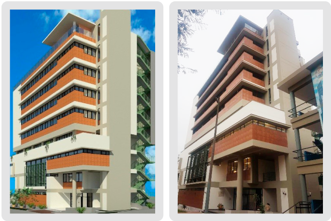
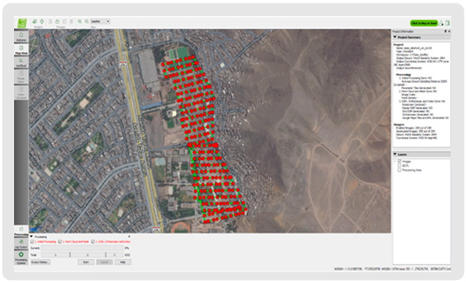
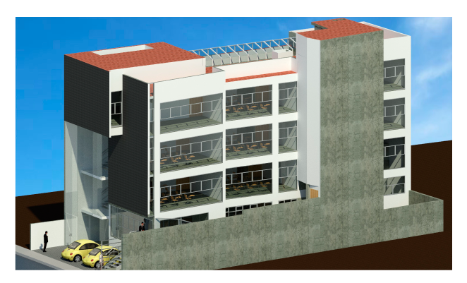
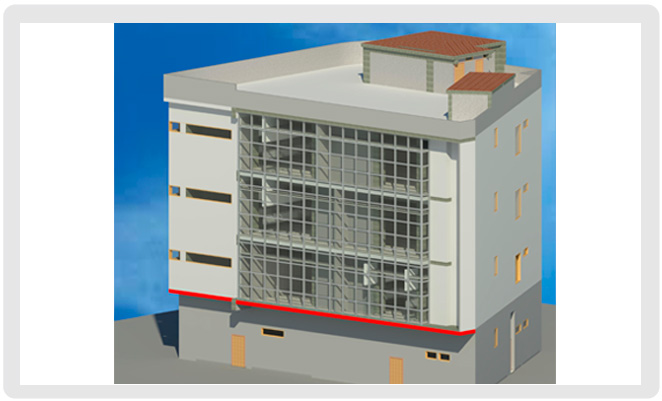
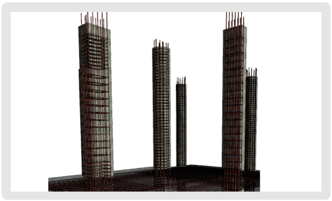
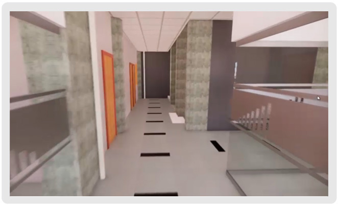
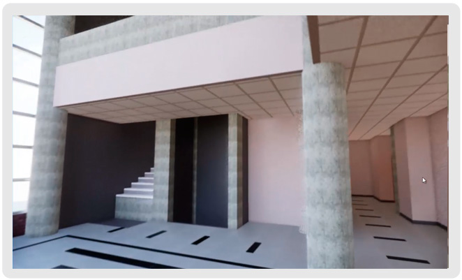
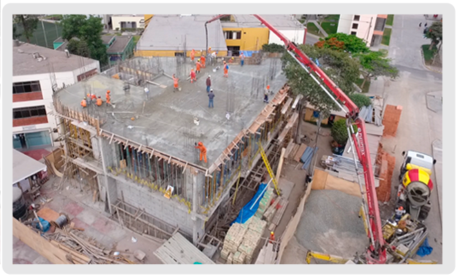
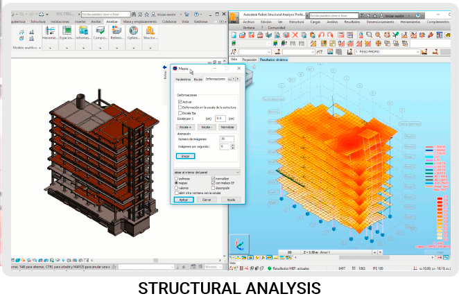
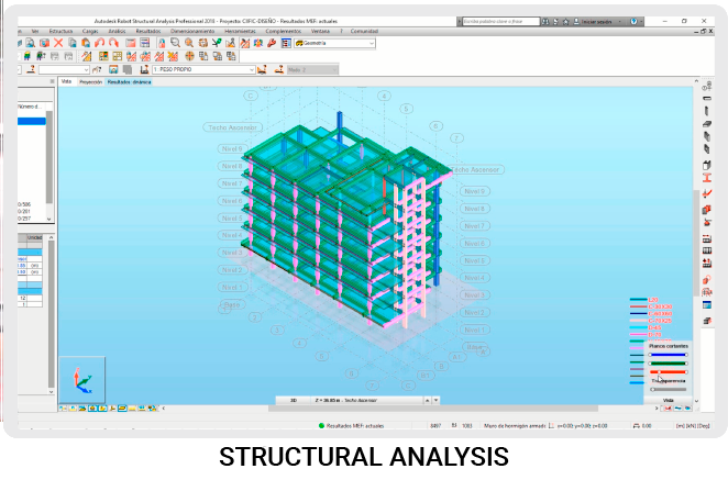
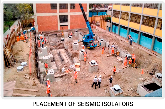
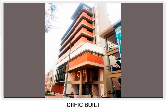
The INFORMATION AND RESEARCH CENTER of the Civil Engineering Faculty at the FIC – CIIFIC is a ten-level building that was also used to experiment with the seismic isolator technology in our environment that mitigates the effect of earthquakes on buildings.


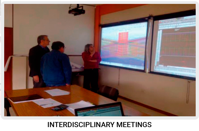
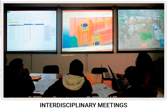
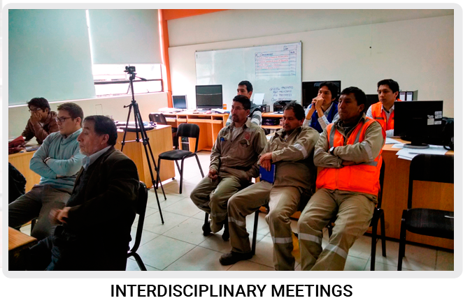
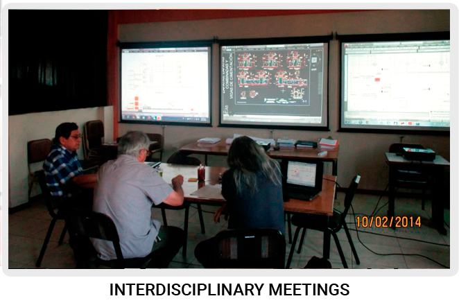
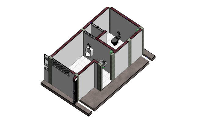
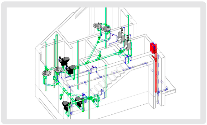
This project was designed by professors of the Academic Department of Structures. The construction management was in charge of the Academic Department of Construction. It was a propitious moment to implement and integrate the Building Modeling into the specialties of architecture, structures, electrical installations and sanitary installations in order to identify designs incompatibilities and make arrangements with the project executors in ICE meetings and get final plans.


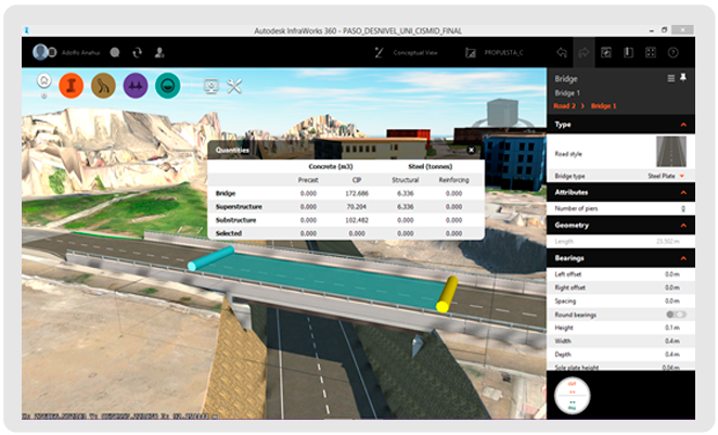
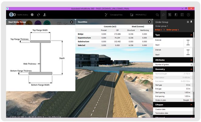
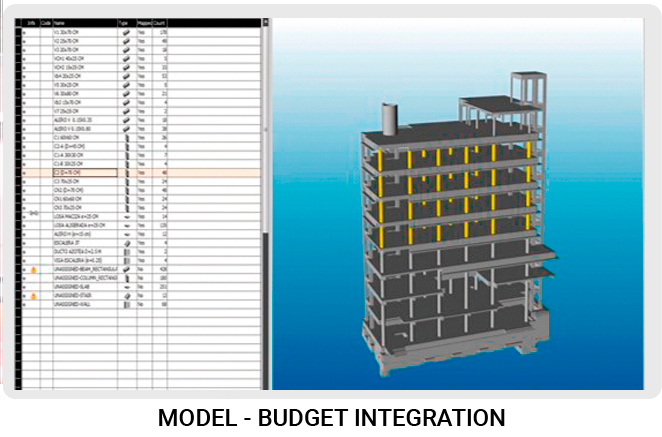
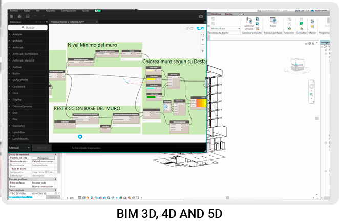
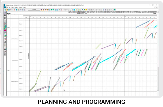
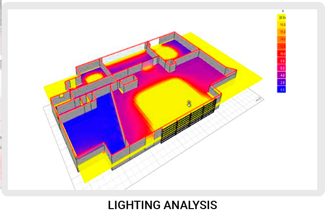
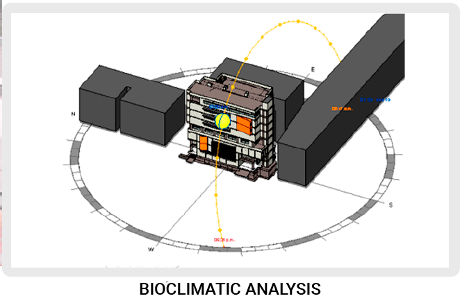
During the project management, we could apply different concepts of BIM methodology such as the compatibility of specialties, 4D and 5D simulation for construction management, climate analysis, structural design verification, etc.
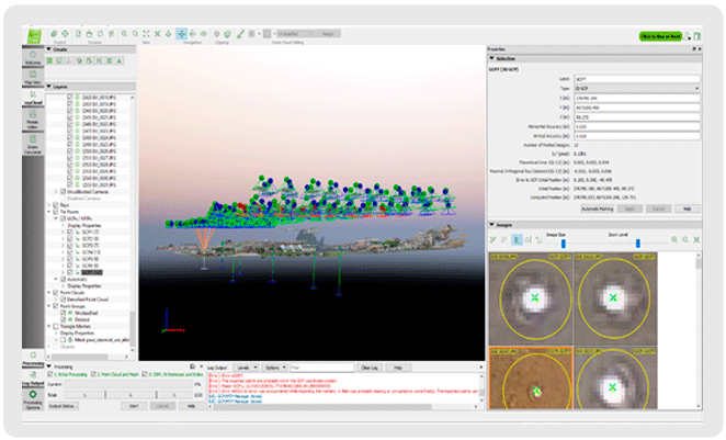
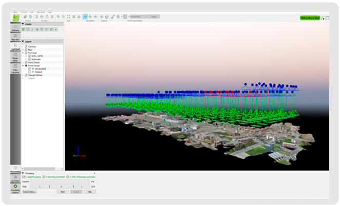
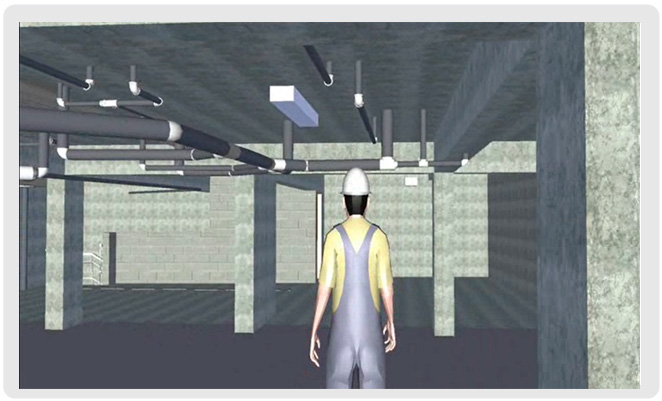
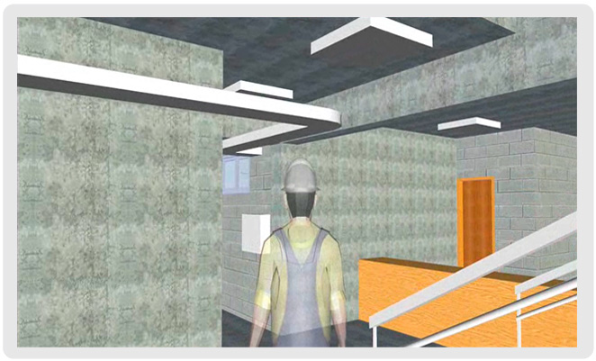
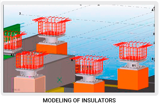
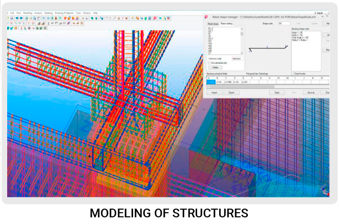
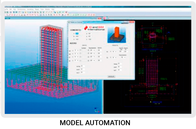
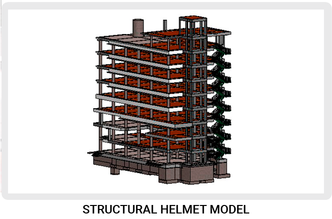
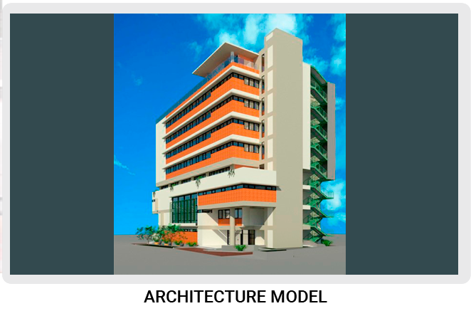


MODELING

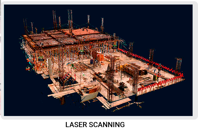
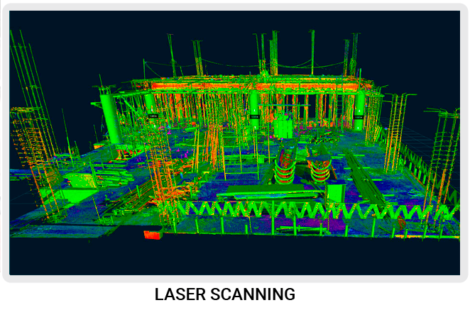
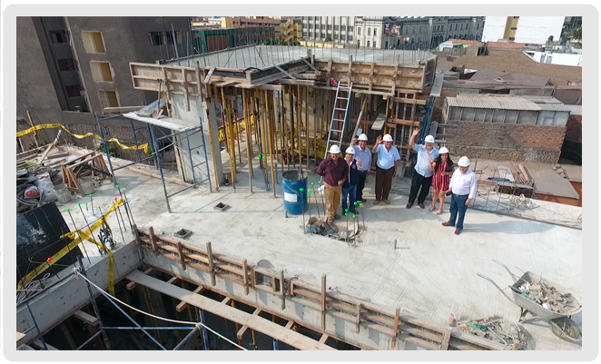
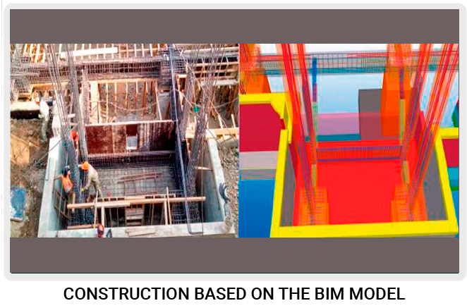
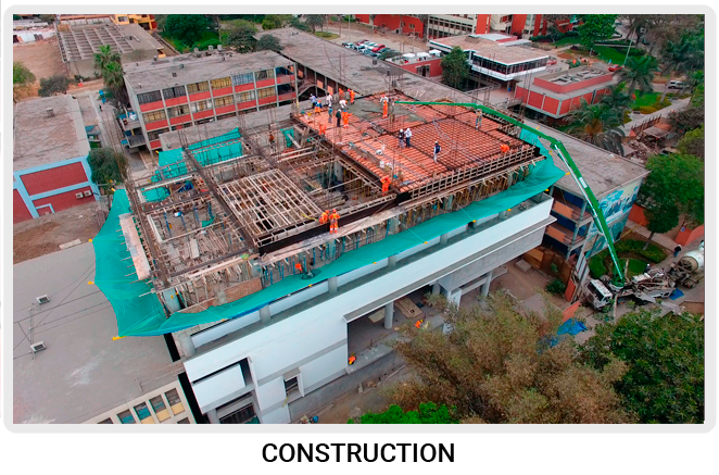
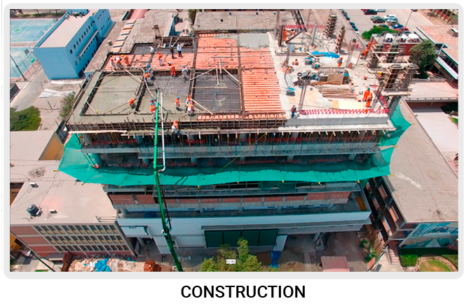
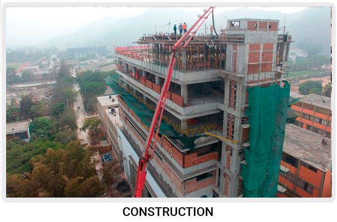
CONSTRUCTION PROCESS
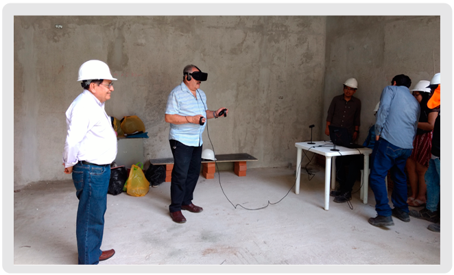
ICE MEETINGS

OVERPASS UNI-

CISMID


Through 360 Autodesk Infraworks software, we implement BIM tools to improve the processes for building design and modeling overpass UNI – CISMID.


It began with the location of the control points properly georeferenced by the differential GPS equipment. In the data analysis stage, we created the network or triangulation of TIN (Triangulated Irregular Networks) points or DTM (Digital Terrain Modeling) used for the generation of the respective surfaces.


The Unmanned Aerial Photogrammetric was carried out, which flight lines of a certain area of the planet are drawn without exception. If we use the camera adapted in the lower part, we can carry out photogrammetric surveys by means of DROM. The flight plan is carried out using the Map Pilot for DJI software, through a closed polygon that will have to cover the entire work area; the software has loaded a map of the whole world so as the vertexes of the closed polygonal are georeferenced. The next step is to give it a starting point, so that the software automatically draws the flight lines for the project according to the height of the flight.

PROJECT

EXTENSION OF SERVICES FOR ACADEMIC TEACHING AND COMPUTER AND INFORMATION TECHNOLOGY RESEARCH OF THE FIM – UNI

PROJECT

IMPROVEMENT OF CULTURAL TRAINING SERVICES AND COMPLEMENTARY TO THE ACADEMIC ACTIVITY OF THE FIEECS-UNI

NATIONAL UNIVERSITY OF ENGINEERING (UNI)

DEPARTMENT OF CIVIL ENGINEERING

Phones: (+51) 938 864 488  |  Address: Av. Túpac Amaru 210, Rímac. Lima 25 - Perú

                (+51) 910 622 473

  • ABOUT US
  • RESEARCH
  • TRAINING
  • PROJECTS
  • CONTACT US
  • Versión en Español